Summit Metro Parks: Hiking Guide
Founded in 1921, the Summit Metro Parks is home to over 15 parks and 150 miles of trails. The Akron area park system has amazing hiking, biking, and horseback riding trails, and other activities for people of all ages.
A popular activity in the fall time in the Summit Metro Parks is the Fall Hiking Spree, which takes place September through November, and has been going on for over 50 years. There’s also the slightly newer event, Spree For All, that the park system puts on.
Liberty Park
Most of the trails range from mostly flat to hilly and some trails get muddier than others after a rainfall. Ticks can be found on some trails and there’s lots of bugs on muggy weather days. Below are some of my favorite trails to hike!
Adam Run Trail
Located in the Hampton Hills Metro Park, this trail definitely became one of my favorites. It’ll take you along the stream (not much water unless there was a recent rainfall). It’s a winding trail with a decent amount of elevation gain, and you’ll eventually come to a part of the trail where the Girl Scouts planted pine trees in the 1960s that is a beautiful section of the trail. If you go on a muggy day, beware of a large number of bugs here, and be prepared to get your feet wet when crossing the streams (if it rained recently).
Length: 3.4 miles, loop
Difficulty: Moderate, moderately trafficked
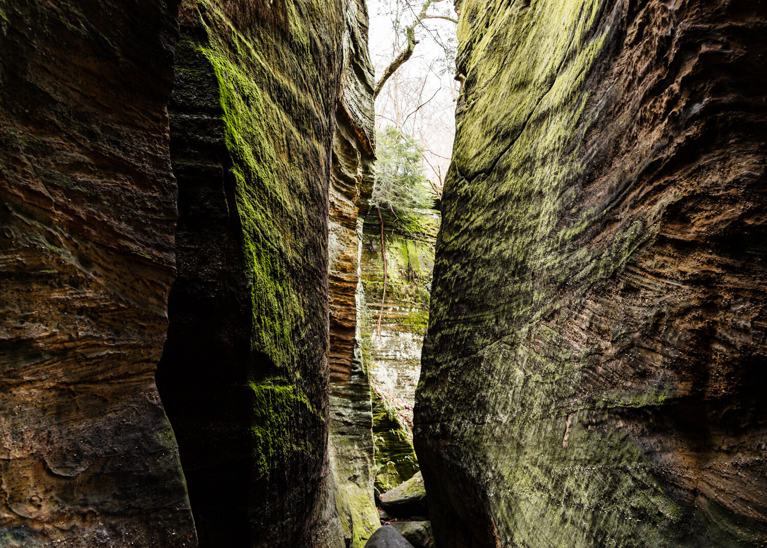
Ledges Trail
The Twinsburg Ledges in Liberty Park is a hidden gem since you wouldn’t expect ledges (rock outcroppings) in this area. The trail itself is fairly easy, and it’ll lead you not only through the ledges but to Glacier Cave as well that you can explore a bit.
Want a longer trail? Combine it with the Black Bear loop for another easy 2 miles.
Length: 1.4 miles, loop
Difficulty: Easy, heavily trafficked
Gorge Trail
The Gorge Trail in the Gorge Metro Park is one of the most popular in the Summit park system. Along the trail, you’ll come across a fishing dock, a dam (with a waterfall), and the Mary Campbell Cave.
Combine this trail with the Glens or Highbridge Trail for a few more slightly challenging miles.
Length: 1.8 miles, loop
Difficulty: Moderate, heavily trafficked
Dogwood Trail
A fairly moderate trail in the Sand Run Metro Park, with lots of foliage and elevation changes. There’s even a couple of mini waterfalls near the road that you can get to from the trail. A lot of the trail takes you along the top of the ridge, and a good length of Dogwood is near the road, but depending on when you go traffic is light.
You could also add in the longer Mingo Trail, which connects Sand Run to the Seiberling Nature Realm. Note that this trail is poorly marked.
Length: 2.3 miles, loop
Difficulty: Moderate, moderately trafficked
Deer Run Trail
Another great trail in the Summit park system is in the O’Neil Woods. Apart from the statewide Buckeye Trail, Deer Run is the only trail located here. The trail consists of a lot of stairs, a road crossing, and other pretty sights along the way; including the O’Neil Woods red barn. There’s a section of Yellow Creek, one of the cleanest tributaries of the Cuyahoga River along this trail as well, which makes for a great pit stop after all those stairs.
Length: 1.8 miles, loop
Difficulty: moderate, moderately trafficked